rareoldprints.com


Search

If you know the reference number
enter it here:


If you enter more than one word
it will be treated as phrase.

Insert "and" or "or" between words to search for the words in any order.

Refine your search here or build another search.
Displaying 10 to 20 of 22 - Next - Previous
87%
Plan of the City and Harbour of Toulon.
Ref: P/28281
Region: Toulon
Type: Copper
Engraver: Jefferys T

87%
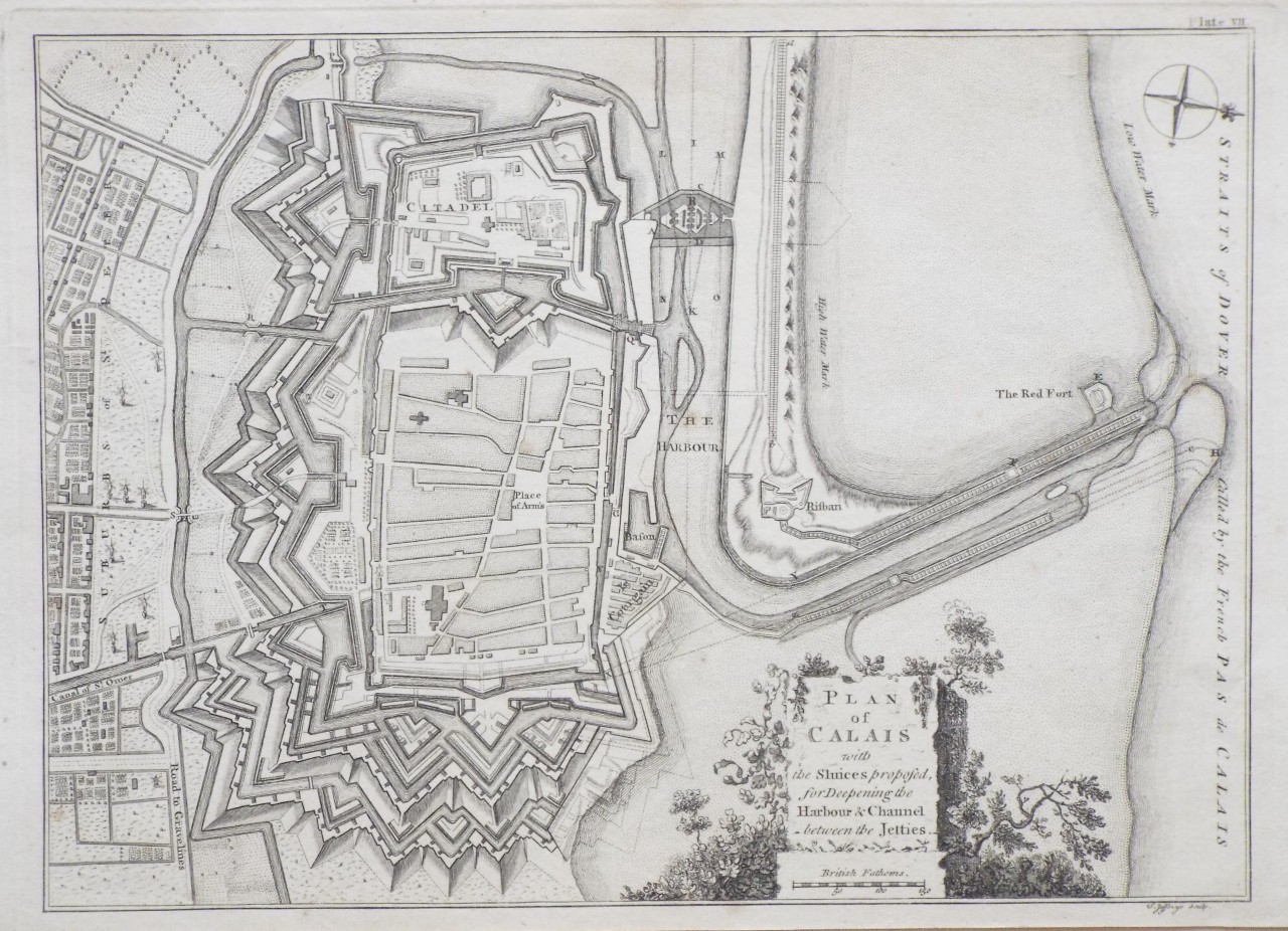
Plan of Calais with the Sluices proposed, for Deepening the Harbour and Channel between the Jetties.
Ref: P/28280
Region: Calais
Type: Copper
Engraver: Jefferys T

87%
Plan of the City and Castle of Caen.
Ref: P/28279
Region: Caen
Type: Copper
Engraver: Jefferys T

87%
Plan of the City of Rouen the Capital of Normandy
Ref: P/28278
Region: Rouen
Type: Copper
Engraver: Jefferys T

87%
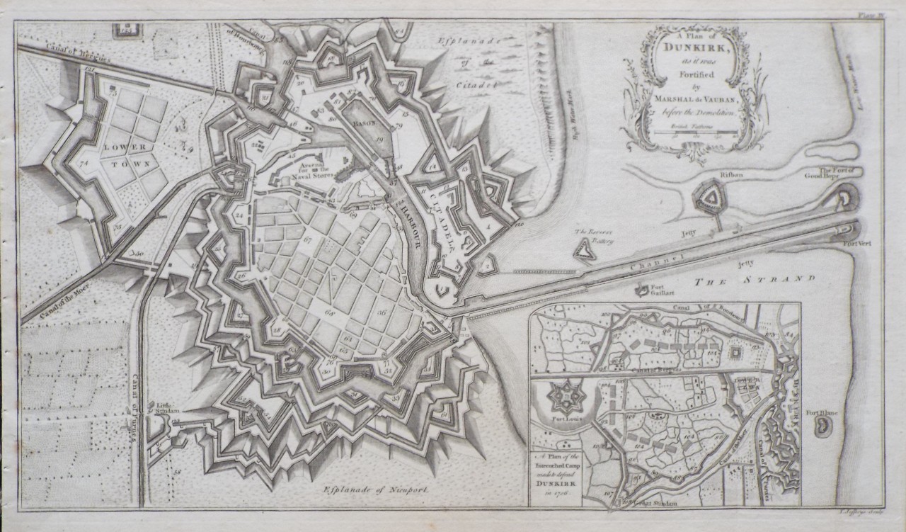
A Plan of Dunkirk, as it was Fortified by Marshal de Vauban, before the Demolition.
Ref: P/28288
Region: Dunkerque
Type: Copper
Engraver: Jefferys T

86%
Plan of the City of Nantes.
Ref: P/28239
Region: Nantes
Type: Copper
Engraver: Jeffereys T

86%
The West Indian Atlas; or a Description of the West Indies: Taken by Actual Surveys and Observations by Thomas Jefferys, Geographer to the King.
Ref: P/28210
Region: West Indies
Type: Copper
Engraver: Jeffereys T
Publisher: Robert Sayer, Chart Map and Printseller, No. 53 in Fleet Street

86%
The Seven United Provinces, with the Austrian, French and Dutch Netherlands
Ref: P/10680
Region: Netherlands
Type: Copper
Engraver: Jefferys T
Date: 1756

86%
The Seven United Provinces, with the Austrian, French and Dutch Netherlands
Ref: P/10681
Region: Netherlands
Type: Copper
Engraver: Jefferys T
Date: 1756

85%
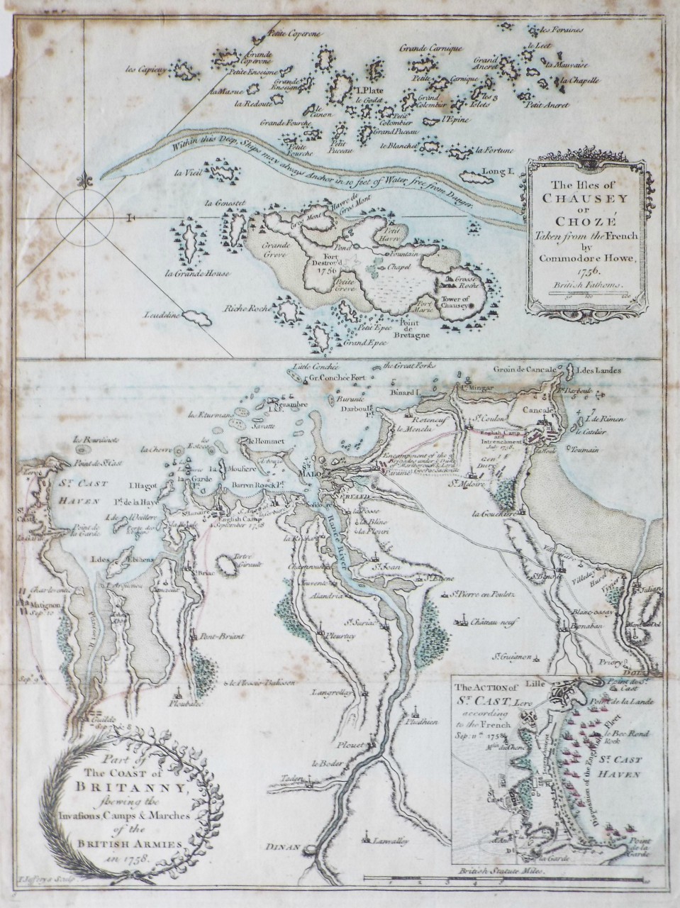
Part of the Coast of Britanny, shewing the Invasions, Camps & Marches of the British Armies in 1758. The Isles of Chausey or Choze Taken from the French by Commodore Howe, 1756
Ref: P/23380
Region: Saint-Malo
Type: Copper
Engraver: Jefferys T

Not for sale

Displaying 10 to 20 of 22